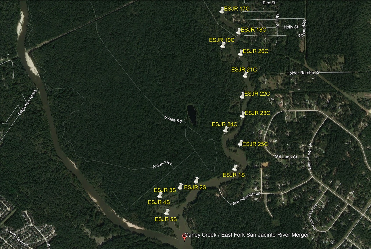
East Fork San Jacinto River
Note 1 - Be forewarned! All caches have been placed coming north from Lake Houston. We have not verified the presence, or the lack thereof, of sand bars, log jams, etc since Hurricane Harvey between the 1485 Kayak Launch and the northernmost cache!
Note 2 - There is a pine tree acorss the river north of ESJR 2C (current northern most cache). The trunk of the pine is ~ 4 to 5 ft above normal river level. While Team 150%'s Predator boat cannot pass the pine due to lack of width between the branches a kayak can easily pass under the truck and between the branches. It is unknown if any obstructions exist in the river above this point.

East Fork San Jacinto River GPS Points & Distances
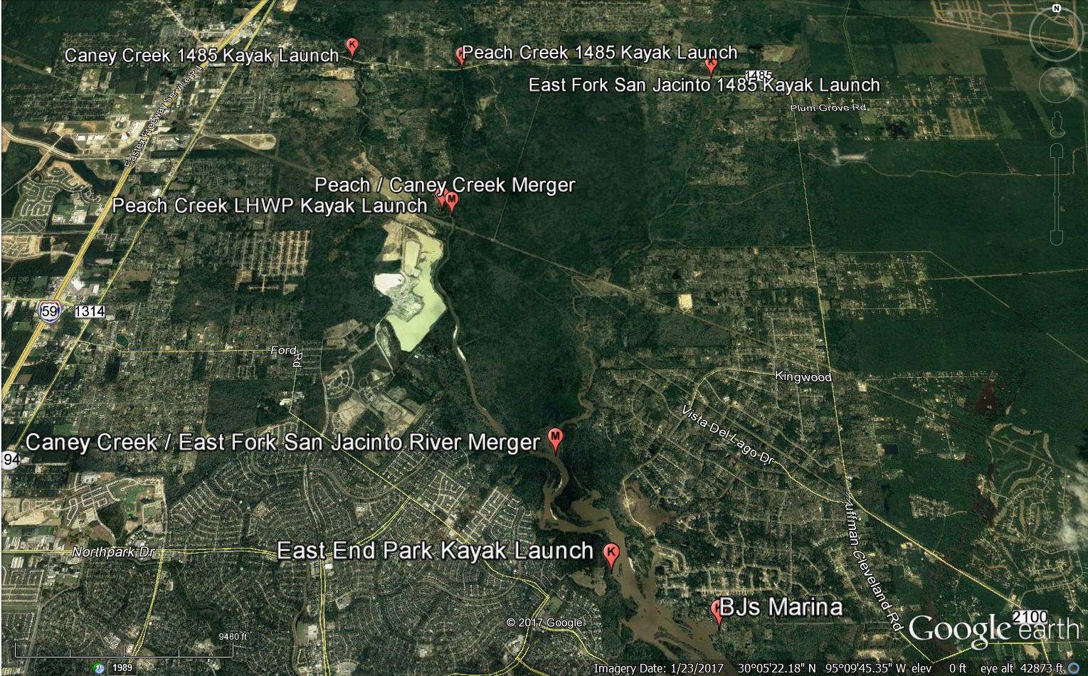
The “East Fork San Jacinto” caches, denoted by cache names ESJR X, are from the kayak launch on FM1485 to the Caney Creek / East Fork San Jacinto River Merger. After making this paddle you will need to continue to paddle down the lake to either East End Park on the west side of the lake or BJ’s Marina on the east side of the lake to take out. Refer to the North Lake Houston section of this document for distances to each.
*Note 1 – This is probably the most difficult paddle of all the various series. It’s a long paddle and should only be attempted by competent paddlers who are comfortable dealing with snakes, alligators, log jam portages, and potentially overnighting on the creek depending on water conditions and speed of paddling / finding. In addition it is the most isolated paddle with very little habitation along its course making reaching you difficult in the event of an emergency.
East Fork San Jacinto 1485 Kayak Launch to Caney Creek / East Fork San Jacinto River Merger – 6.5 miles
East Fork San Jacinto 1485 Kayak Launch
N 30° 8.695’
W 95° 7.499’
Caney Creek / East Fork San Jacinto River Merger
N 30° 4.854’
W 95° 9.269’

East Fork San Jacinto #2
East Fork San Jacinto #3