Peach Creek
Peach Creek GPS Points & Paddle Distances
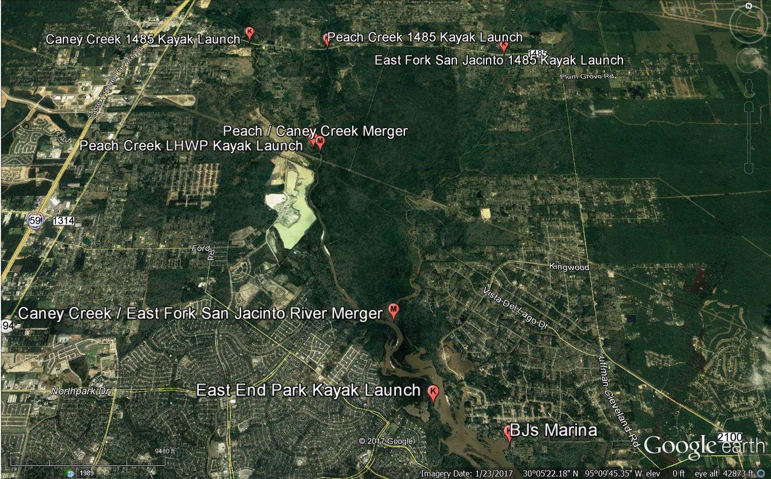
The “Peach Creek” caches, denoted by cache names PC X, are from the kayak launch on FM1485 to the kayak launch at Lake Houston Wilderness Park (LHWP). The launch at 1485 is easily accessible by a vehicle with decent clearance however we do not recommend a car as the ground can be a little bumpy leading to high centering. Launching can be a little tricky as the bank is steep and typically not mowed. The takeout at LHWP on Peach Creek is a ~ 75 yard carry up a sand hill and can be accessed in any type of vehicle.
Peach Creek Hwy 1485 Kayak Launch to Lake Houston Wilderness Park (LHWP)Kayak Launch – 2.21 miles
Peach Creek Hwy 1485 Kayak Launch
N 30° 8.808’
W 95° 10.294’
Lake Houston Wilderness Park (LHWP) Kayak Launch
N 30° 7.160’
W 95° 10.428’
Lake Houston Wilderness Park Kayak Launch to Peach / Caney Creek Merger – 0.2 miles
Lake Houston Wilderness Park (LHWP) Kayak Launch
N 30° 7.160’
W 95° 10.428’
Peach / Caney Creek Merger
N 30° 7.103’
W 95° 10.322’